The high-resolution network will improve Oceania’s resilience to severe weather events and provide meteorological agencies and commercial users with a level of lightning visibility never before seen.
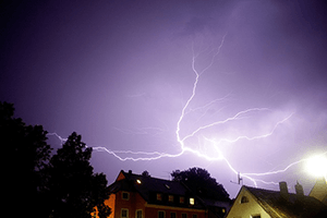
Lightning is one of the most dangerous and frequently encountered weather hazards. It can take lives, cause severe injuries, damage vital infrastructure, and disrupt commercial operations. These disruptions include operational impacts upon airports, energy utilities, communications networks, and the tourism industry upon which some Pacific economies are dependent.
The concept of a pan-Oceania sub-network of the global TOA lightning location network grew quickly from an idea discussed at the 2016 InterMET Asia conference, where MetraWeather, TOA and Tonga Meteorological Service staff talked about the feasibility of the project.
Senior Forecaster at Tonga Meteorological Service, Moleni Tu’uholoaki, was a delegate at InterMET Asia. He says the introduction of the lightning technology echoes how Pacific Islanders have for centuries noted the presence of the Lesser Frigate Bird (Fregata Minor) near or over land as a predictor of when there is bad weather and tropical cyclones out to sea.
“The lightning location system will help improve meteorology capability in our region, in a similar way to how the Frigate Bird supported past generations,” says Moleni.
The first phase of the program has seen the planned installation of TOA sensors in the Cook Islands, Fiji, Niue, Raoul Island, Samoa, American Samoa, Tokelau, and Tonga.
Data from these installation sites is combined with information from other TOA lightning sensor installation sites to form a true lightning detection network, with many sensors in the network detecting the same single lightning event thus introducing improved detection efficiency, location accuracy and redundancy to the network.
Source: MetraWeather